Story 06 · Clywedog valley, Powys
The valley and the bomb
In the 1960s a valley of hill farms and old lead mines above Llanidloes was cleared to steady the River Severn. A bomb delayed the dam, and the concrete wall that went up is the tallest of its kind in the UK.
Chapter 1 · Before 1963
The valley
The River Clywedog runs down from the foothills of Pumlumon and joins the Severn at Llanidloes. Its fortunes were tied to two industries, lead mining and wool. The mines of Van, Bryntail and Penyclun lay north of the town, and the hills above held small farms and cottages, chapels and a Quaker cemetery.
In 1962 the River Severn Water Resources Committee suggested that the Clywedog valley should be flooded to provide extra water, mostly for local authorities in England.
Chapter 2 · 1963
The Act
The Clywedog Reservoir Joint Authority Act 1963 gave the go-ahead. Its main purpose was to regulate the flow of the Severn: to hold winter rain, release it in dry weather, ease flooding, and support drinking-water abstractions for the West Midlands.
The reservoir would drown 615 acres of farmland. Local opposition was strong, and a heritage survey compares it to the opposition at Tryweryn a few years earlier.
- 1962A committee suggests flooding the Clywedog valley.
- 1963The Clywedog Reservoir Joint Authority Act is passed.
- 1964Residents of Aberbiga are evicted. Construction begins.
- 6 Mar 1966A bomb wrecks the site’s cableway.
- 1967The dam is completed.
Chapter 3 · 1964
The farms
In 1964 the six farms of the small community of Aberbiga were cleared to make way for the reservoir. Families named in later accounts include the parents of the harpist Elinor Bennett and the family of the tenor Aled Wyn Davies. Protests were held at the time.
The flooding took in small irregular fields and a string of farms, old farms and cottages. A heritage survey names Aber-biga, Gronwen, Eldid, Croes-isaf, Grodir, Coppice-llwyd, Llwybr-y-madyn, Ystrad-hynod, Merllyn and Draws-y-nant. Before the water came, archaeologists excavated the Ystradhynod Bronze Age burial mound and its standing stone in 1965 and 1966.
Chapter 4 · 1966
The bomb
On 6 March 1966 a bomb destroyed the overhead cableway on the construction site. It caused about £30,000 of damage and put the work back by around six months. The group Mudiad Amddiffyn Cymru was widely suspected, though responsibility was never a settled fact in the sources we found.
About 500 workers lived in temporary buildings on the hillside above the dam. Sir William Halcrow and Partners designed the works and Reed and Mallick of Salisbury were the main contractors.
Chapter 5 · 1967 to today
The dam
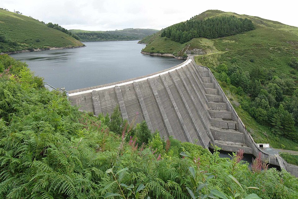
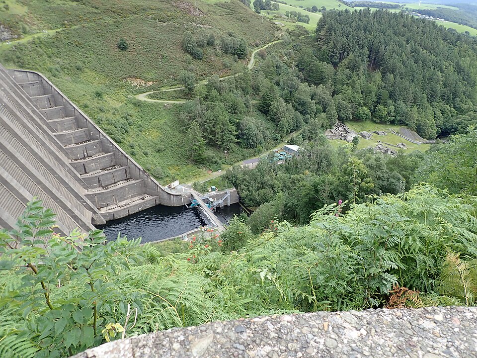
The dam is made of 11 separate hollow concrete buttresses. It curves downstream rather than upstream, because the engineers were worried about the strength of the rock in the valley sides, and the buttresses carry the water’s thrust down to the valley floor. It is 72 metres high and 230 metres long, the tallest concrete dam in the UK.
A smaller embankment dam at Bwlch-y-gle, beside the B4518, stops the water spilling into the next valley. The reservoir is owned and run by Severn Trent. It fills over the winter and is released in dry summers to keep the Severn flowing. A 500 kilowatt turbine powers the dam’s own plant.
Today the lake is a place for walking, cycling, birdwatching, fishing, windsurfing and sailing. At the foot of the dam lie the ruins of the Bryntail lead mine, and in 2005 Natural Resources Wales put up a platform for nesting ospreys.
Sources and credits
Photographs are credited. Where sources disagree we say so above.
- Wikipedia, Clywedog Reservoir; Reservoirs of Wales
- CPAT, The Clywedog Valley: Clywedog Reservoir (Historic Landscape Characterisation)
- CPAT, The Clywedog Valley, introduction
- Coflein, Clywedog Dam
- Press, 7 August 1962, via Papers Past
- Wikishire, Llyn Clywedog
Photographs
- The dam and reservoir, August 2010: Nigel Davies, via Geograph and Wikimedia Commons, CC BY-SA 2.0.
- The spillway and valley below the dam, August 2020: Eirian Evans, via Geograph and Wikimedia Commons, CC BY-SA 2.0.
More to come
More storiesHave one to suggest? helo@danydwr.co.uk